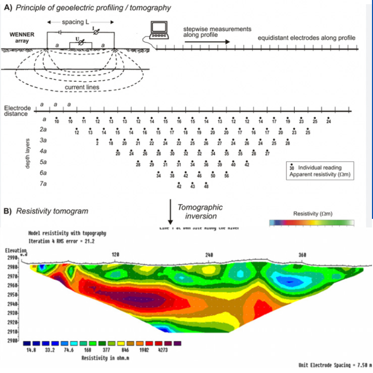
Electrical Resistivity Tomography (ERT) method used to determine the subsurface's resistivity distribution by making measurements on the ground surface. The eletrical current is injected into the earth through a pair of current eletrodes, and the potenial difference is measured between a pair of potential eletrodes.
Applications
- Determine the underground water resource
- Detects weak zones under rock surface (not detected by seismic refraction)
- Delineation of small features like cavity, contamination plumes, weak zones in structures like dams etc.
- Bedrock quality and depth measurements
- Mineral prospecting, Dam structure analysis, Landfill
